一、前言
之前版本使用相机后期处理实现,参见相机后期处理实现指北针,当开启对数深度缓存后,指北针就显示不正常了,本人感觉这种实现有点太繁琐、太耗性能了,后续维护起来也不方便,故采用osg原生图形界面的方式实现。
二、效果
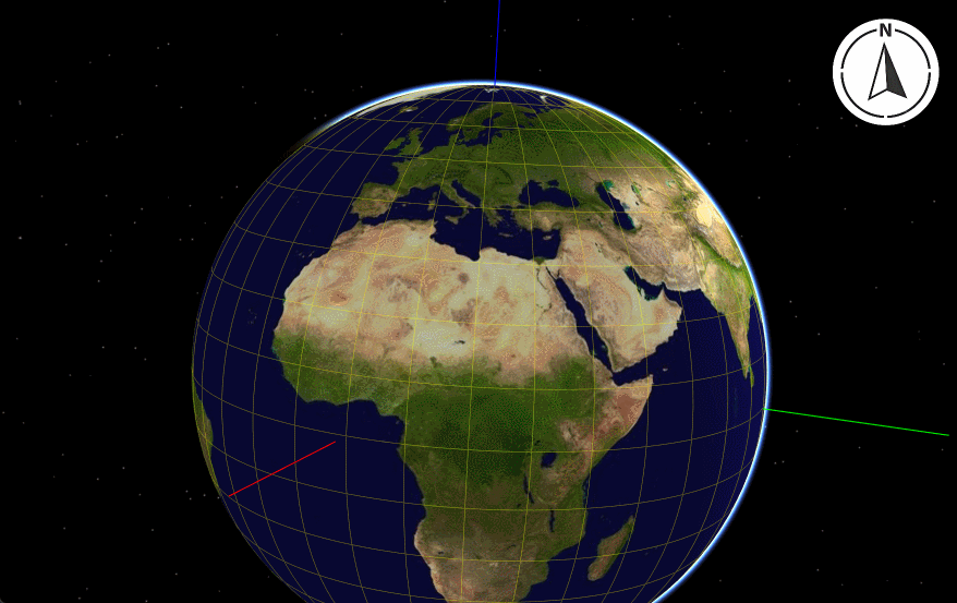
以下图片可自行换成自己的

三、实现
VDCompassUseCanvas.h
cpp
/***********************************************************************
 * 功能:指北针(使用界面canvas实现)
 * 作者:xxx
 * 历史:2026年2月12日09:55:35新建。
 ***********************************************************************/
#pragma once
#include <osgEarth/Controls>
#include <osgViewer/Viewer>

class VDCompassUseCanvas :public osgEarth::Util::Controls::ControlCanvas
{
public:
	VDCompassUseCanvas(osgViewer::Viewer *view);
	~VDCompassUseCanvas();

	void SetHeading(const double &heading);

private:

	osg::ref_ptr<osgEarth::Util::Controls::ImageControl> m_pImageControl = nullptr;
};
VDCompassUseCanvas.cpp
cpp
#include "VDCompassUseCanvas.h"
#include <osgDB/ReadFile>
#include <QCoreApplication>
VDCompassUseCanvas::VDCompassUseCanvas(osgViewer::Viewer *view)
{
	if (!view) {
		OE_FATAL << "create compass error,viewer is invalid." << std::endl;
	}
	else {
		getOrCreate(view);
		//绘制背景
		osg::ref_ptr<osg::Image> imageBG = osgDB::readImageFile((QCoreApplication::applicationDirPath() + QString("\\data\\image\\compass-b4.png")).toStdString());
		if (imageBG.valid())
		{
			osg::ref_ptr<osgEarth::Util::Controls::ImageControl> imageControl = new osgEarth::Util::Controls::ImageControl(imageBG.get());
			imageControl->setHorizAlign(osgEarth::Util::Controls::Control::ALIGN_RIGHT);
			imageControl->setFixSizeForRotation(true);
			imageControl->setSize(100, 100);
			addControl(imageControl.get());
		}
		//绘制指针
		osg::ref_ptr<osg::Image> image = osgDB::readImageFile((QCoreApplication::applicationDirPath() + QString("\\data\\image\\compass-p2.png")).toStdString());
		if (image.valid())
		{
			m_pImageControl = new osgEarth::Util::Controls::ImageControl(image.get());
			m_pImageControl->setHorizAlign(osgEarth::Util::Controls::Control::ALIGN_RIGHT);
			m_pImageControl->setFixSizeForRotation(true);
			m_pImageControl->setSize(100, 100);
			addControl(m_pImageControl.get());
		}
	}
}

VDCompassUseCanvas::~VDCompassUseCanvas()
{
	OE_NOTICE << "~VDCompassUseCanvas" << std::endl;
}

void VDCompassUseCanvas::SetHeading(const double &heading)
{
	if (m_pImageControl.valid())
		m_pImageControl->setRotation(osgEarth::Angular((heading), osgEarth::Units::DEGREES));
}
原创不易,记得点赞加关注哦,我会持续分享实用的功能(:-